

Prosper · Aerial Media
What to Send Before a Prosper Vacant-Lot Drone Shoot
Prepare a Prosper lot-media brief with parcel identification, access, a client-supplied map, priority views, and clear limits for boundary graphics.
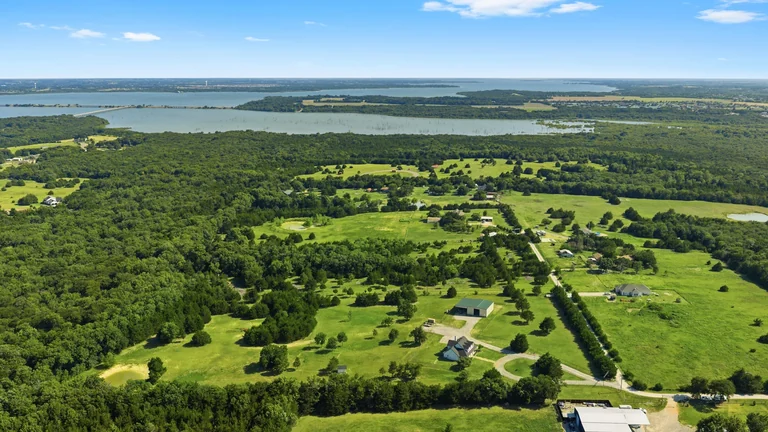
Before a vacant-lot drone shoot in Prosper, send more than a pin dropped near an open field. The team needs to identify the correct parcel, understand access, and know which visible relationships the media should explain.
A useful brief separates the land's verified information from the approximate graphics used to help viewers orient themselves.
Identify the parcel with dependable information
Provide the listing address or parcel identification and the client-supplied survey, plat, or parcel map needed for any boundary overlay. If a street address leads to a nearby home rather than the lot entrance, explain that difference.
Tell FLM which source should govern labels. Do not ask the photographer to infer a property line from grass color, a fence, a driveway, or a neighboring building.
Explain how the site can be accessed
- Name the approved entrance and a reachable contact.
- Describe gates, access restrictions, and any site check-in requirement.
- Identify ongoing work or conditions that may affect the visit.
- Confirm which areas the team is authorized to enter.
- Provide arrival instructions privately rather than putting security details in public copy.
The pilot will assess the actual flight conditions. A clear day and an open lot do not establish that every planned flight is permitted. The FAA's airspace resources explain why location-specific checks matter.
Describe the buyer question behind each view
Ask for the context you need to communicate: the parcel's visible shape, relationship to the road, neighboring development, or a feature that can actually be seen. Mark any requested point of interest on the map so its location is not guessed during editing.
Aerial images do not establish utility availability, buildability, easements, drainage performance, or legal boundaries. Keep those claims tied to the appropriate verified records and professional sources.
Choose clean views and overlays deliberately
FLM's current vacant-land products distinguish clean aerial photography from additional versions with approximate property-line graphics. Lot Showcase adds a finished aerial video; larger acreage or expanded labels may need custom coverage.
Keep clean originals as well as labeled versions. Make sure an approximate marketing outline cannot be mistaken for a surveyed boundary, and review the graphic against the supplied source before publishing.
Confirm the deliverables before the visit
Specify whether you need still photos, video, an output orientation, or additional locations. Those choices affect the production plan. A request for both vertical and horizontal edits should be discussed rather than assumed.
Use the FLM vacant-land product list to compare current scope, then send the parcel materials with your request for aerial media.